Forks Of Salmon
Siskiyou county
CALIFORNIA
Getting Here
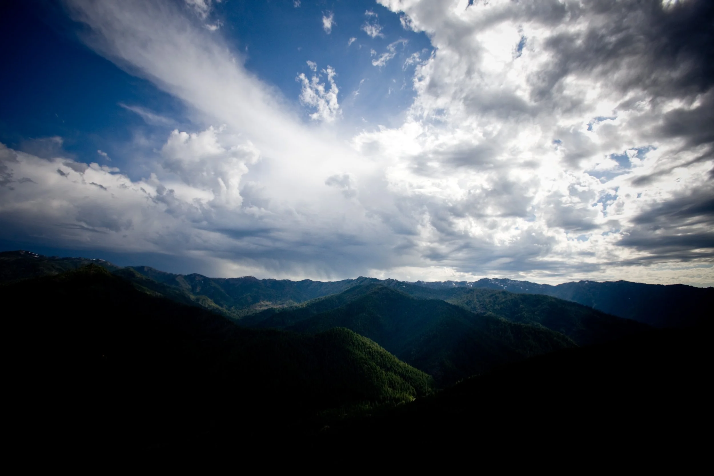
[ OVERVIEW ]Otter Bar Lodge is remote. There are no close cities and the closest airport (Medford, Oregon) is more than 3 hours away. Expect narrow winding roads and mountain passes. We recommend slowing down and enjoying the gorgeous scenery of this special part of the world.
14026 Salmon River Road
Forks of Salmon, CA 96031
Smartphone maps will generally get you here, but we recommend following the directions below. Please note that in the spring, Grayback is sometimes closed, and map apps may still route you that way, so use caution.
[ Arrival ]From Oregon or Washington
Take I-5 south into California. Continue to the Yreka exit labeled “Fort Jones – Highway 3” (exit #773). Turn right at the exit ramp then left at the light onto Highway 3 going south.
Continue over the mountain to Fort Jones and onward to Etna (25 miles from I-5). Just outside of Etna, Highway 3 turns abruptly left. Continue straight ahead into Etna without turning left with Highway 3. Make a right turn at the T-intersection downtown onto Main Street.
Follow this road over the mountain (it becomes one lane), past the tiny town of Sawyers Bar (go slow, please) and downriver along the North Fork to Forks of Salmon (42 miles or 1 1/2 hours from Etna). The road bears right in Forks of Salmon. Continue 1 1/2 miles to Otter Bar. We are on the left down a gravel drive, there is a blue mail box on the right hand side which says “Otter Bar” and the address: 14026. Approximately 7 1/2 hours from Portland. Be sure to fill up at one of the gas stations in Yreka, Fort Jones, or Etna, CA.
This route will take you approximately 2 hours from Yreka.
Please take extra caution when driving on the narrow mountain roads of our area: stay to the right, be prepared for oncoming traffic at all times, and –most of all– please drive slowly and use your gears to slow yourself down the mountain pass.
NOTE: if you are coming via I-5 from north of Grants Pass, OR, a shorter route is possible during summer months only after the snow has melted and mountain roads are re-opened (via a paved road linking O’Brien, OR on US 199 to Happy Camp, CA on CA Hwy 96). Please call us for more info and to find out if the road is open for the season before attempting this route)
From California (South)
Take the I-5 exit marked “Edgewood – Gazelle” (exit #751).
When you reach Gazelle turn left and follow the road over the mountain to Callahan (30 miles; 1 hour).
Turn left just after the tiny town of Callahan (onto Cecilville Rd.) and go over the mountain and down the South Fork Salmon via Cecilville until you reach a T-intersection in Forks of Salmon (40 miles or 1 1/2 hours from Callahan; please note that the road becomes one lane near Cecilville).
Turn left at the T-intersection entering Forks. Continue 1 1/2 miles to Otter Bar. We are on the left down a gravel drive. There is a mail box on the right hand side which says “Otter Bar” and the address: 14026. Approximately 7 1/2 hour drive from San Francisco; 2 1/2 hours from I-5.
Or, a slightly more relaxing way is to come in via Yreka, CA:
Continue north on I-5 to exit #773 (“Fort Jones – Yreka – Hwy 3”) and take a left at the end of the exit ramp and continue to the light at Highway 3 and turn left.
Continue over the mountain to Fort Jones and onward to Etna (25 miles from I-5). Just outside of Etna, Highway 3 turns abruptly left. Continue straight ahead into Etna without turning left with Highway 3. Make a right turn at the T-intersection downtown onto Main Street.
Follow this road over the mountain (it becomes one lane), past the tiny town of Sawyers Bar (go slow, please) and downriver along the North Fork to Forks of Salmon (42 miles or 1 1/2 hours from Etna). The road bears right in Forks of Salmon. Continue 1 1/2 miles to Otter Bar. We are on the left down a gravel drive, with a blue mail box on the right hand side of the road that says Otter Bar and the address: 14026.
Please take extra caution when driving on the narrow mountain roads of our area: stay to the right, be prepared for oncoming traffic at all times, and –most of all– please drive slowly and use your gears to slow yourself down the mountain pass.
[ MAPS ]Maps
Get a full color detailed Google Map of our area with driving directions from your location.
For those of you using a GPS or onboard navigation system, our lodge is located at: 41° 16’30.30″ N, 123° 20’47.63″W.
The driving directions above give the best routes to us.
Beware: many online map services do not accurately display our location. We recommend following our directions. There have been problems with Mapquest and GPS directions.
To make sure of the most direct route, you should give us a call.